GeoStar Features
The RESOlution control software, GeoStar, has been designed to offer an intuitive interface with a simple and attractive layout and rich visual controls. Well-designed software is very important, since many LA-ICP-MS laboratories host external visitors, or experience a high turnover of new users of assorted experience, from students to senior professors. GeoStar will minimize learning time and alleviate training obligations for the laboratory manager, and comes with a complete set of video tutorials as well as a detailed and helpful manual.
Graphical Point/Path Definition
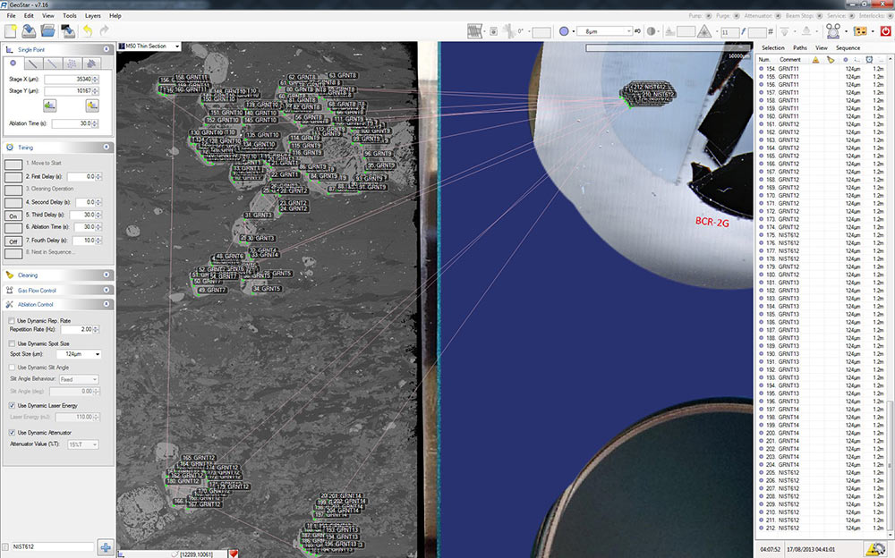
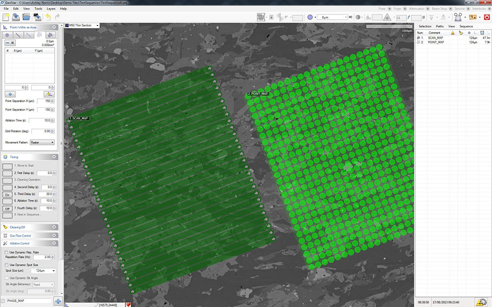
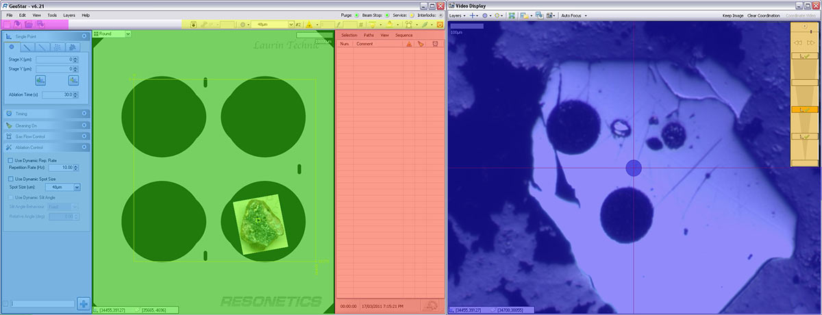
Offering an intuitive visual display, GeoStar allows for points and paths to be defined using a range of options. Compound shapes allow points along a line, or points and paths within an area, to be rapidly defined and manipulated. All shapes can be edited using the mouse, or nudged by fixed amounts. This combination of precision control and free-form manipulation allows all users to prepare and edit their analytical sequences with ease.
Automatic or Manual Operation
GeoStar has been designed with automation in mind, but can also be used manually by abating point-by-point. When creating an automated sequence the software supports over five thousand points in a sequence, and offers:
- Drag and drop reordering
- Cut and paste reordering
- Undo and redo operations
- Visual and name-based selection
- Powerful editing features
Automatic Distribute Tool
The automatic distribute tool greatly simplifies the process of bracketing standards and unknowns. After creating (or importing) a sequence of sample points, the user creates the required number of standard points and, with a few mouse clicks, the standards are distributed throughout the sequence.
Logging Choices
While ablating a sequence, it is quite important to create a reliable record of the ablation process. GeoStar offers a range of logging choices, including:
- Verbose human-readable text log
- Concise machine-readable CSV file
- MPEG4 video recording
- Before-and-after image capture
Norris Software is also able to create additional log formats on request.